We’re introducing today a new feature to our NOTAM and weather monitoring platform.
You’re probably pretty familiar with text NOTAMs like the one hereafter, but how many times have you been actually spotting on a map the area defined with coordinates?
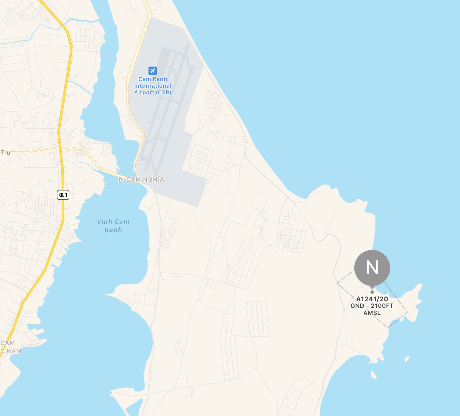
🗺 NOTAMN VVTS A1241/20
W-[BO]/001NM FIR VVTS
[17]07:00 ↔️ [20]08:00
FRNG WILL TAKE PLACE WI:
115737N1091613E - 115650N1091649E - 115636N1091631E - 115716N1091545E
- 115737N1091613E
BRG: SE
- ALL FLIGHTS ARE PROHIBITED WITHIN THIS AREA.
- DURING THIS TIME, DEP/ARR ACFT IS NOT TEMPO OPERATED AT CAM RANH
INTL AP.
GND ↕️ 2100FT AMSL
⏱ 17 0700-0800 2330-2359 18 0000-0010 0040-0120 19 2330-2359 (RESERVE DAY) 20 0000-0010 0040-0120 0700-0800 (RESERVE DAY)
✨【DISPLAY ON MAP】
Our @blinkAeroBot will display a map overlaying the region for you. You just have to click