Off 2
Your offline flight companion — a NASA-imagery 3D globe, real-time ETA, airport details, and day/night crossings without internet.
- Offline flight tracking on a NASA Blue Marble 3D globe — no internet required at any point
- An arrival estimate modelled on the whole flight and calibrated against real flown routes
- v2.4 adds an optional high-resolution globe — four times sharper as you zoom, still fully offline
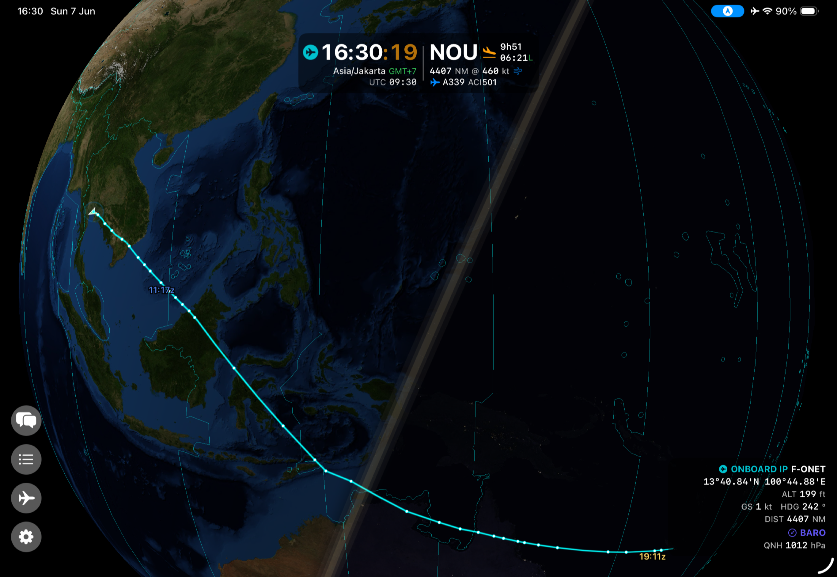
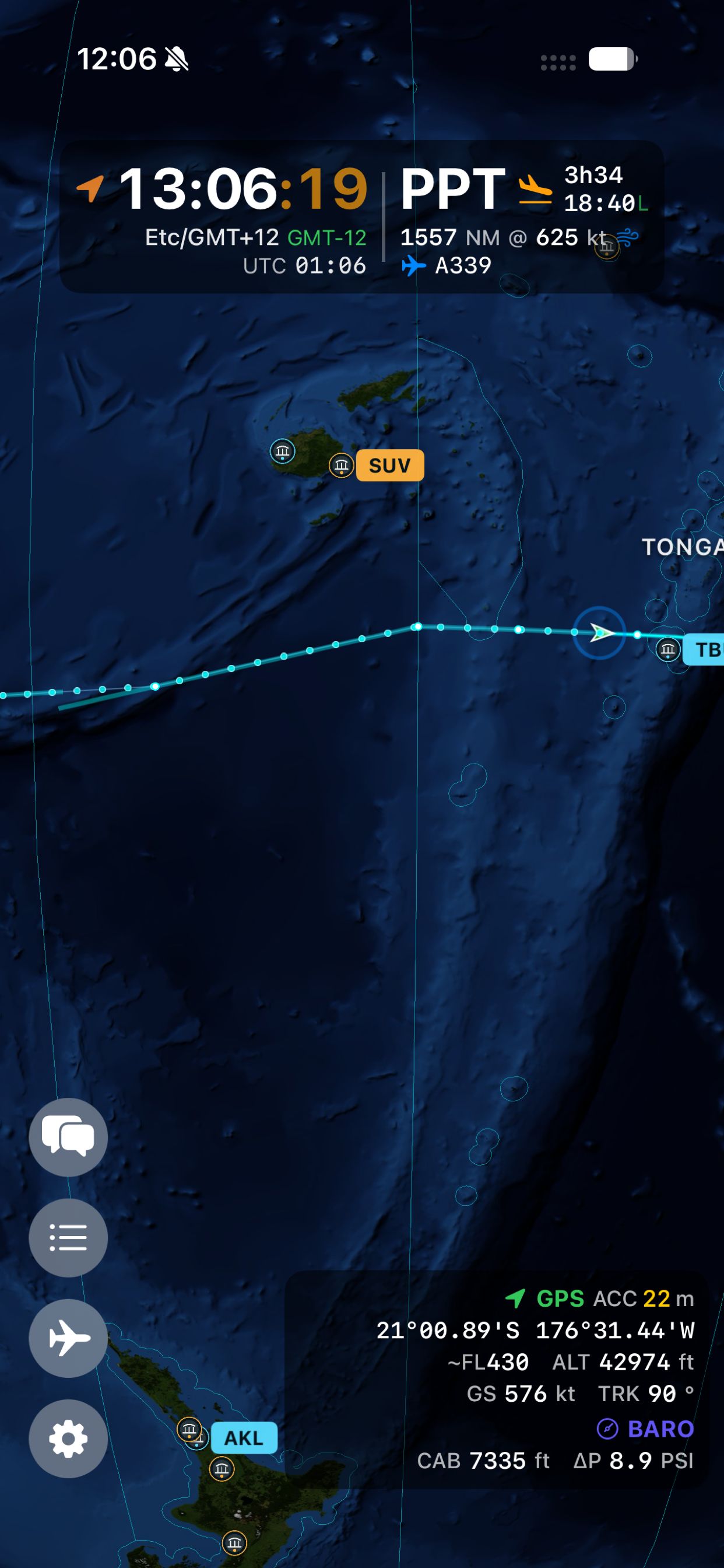
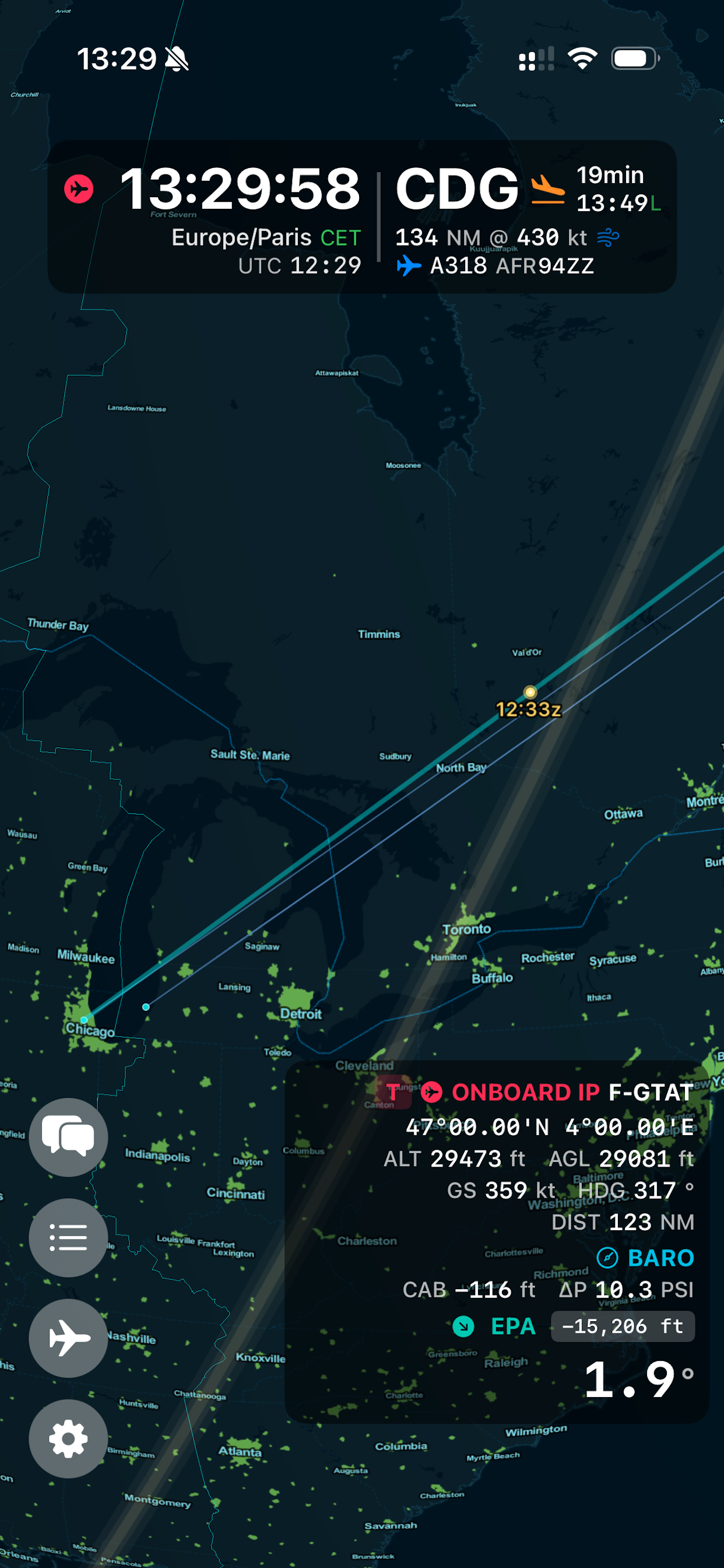
Off 2 is a flight companion app built for pilots, frequent travelers, and aviation enthusiasts who want meaningful flight data without depending on connectivity. Whether you are crossing the Pacific or flying in and out of radar coverage, Off 2 gives you a live picture of your flight without touching the internet.
The 3D globe
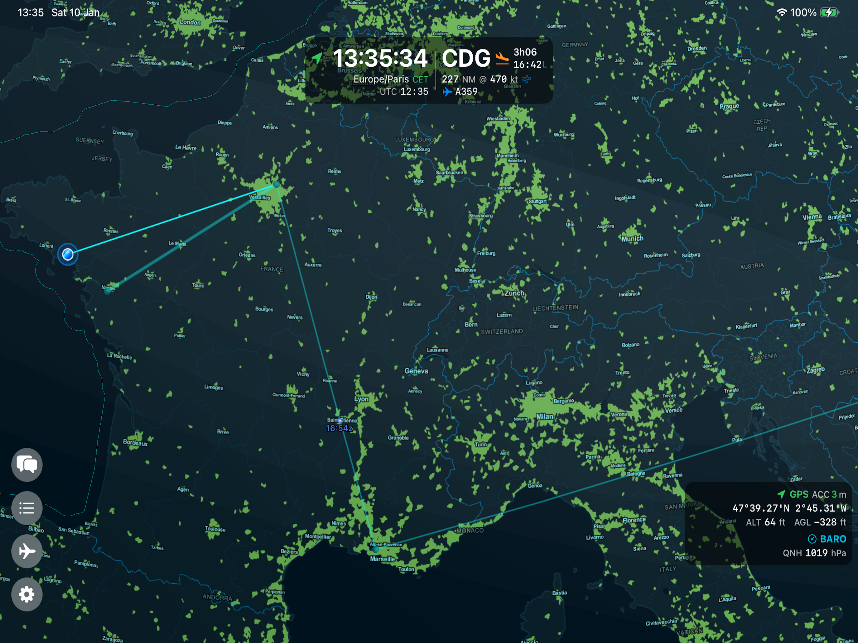
The centerpiece of Off 2 is a high-quality 3D globe rendering your current position, route, and the live day/night terminator. As of version 2.0 it is painted with NASA Blue Marble satellite imagery by day and Black Marble city lights by night, blending at the real terminator for a beautiful, realistic Earth. Unlike map-based apps, the globe gives you the true geometry of your flight path — great circle routes look like great circles, not distorted arcs.
Version 2.4 adds an optional high-resolution version of that imagery for Pilot Mode, four times sharper as you zoom in. Everything stays offline: it downloads once, then never needs the network again.
What’s new in version 2.4.2
A reliability release, centred on the itinerary.
- The itinerary no longer crashes — deleting a sector from a multi-sector trip could close the app immediately. That is fixed. Deleting or reordering a sector also no longer moves the times you set on the other legs, which was the quieter and more damaging half of the same problem.
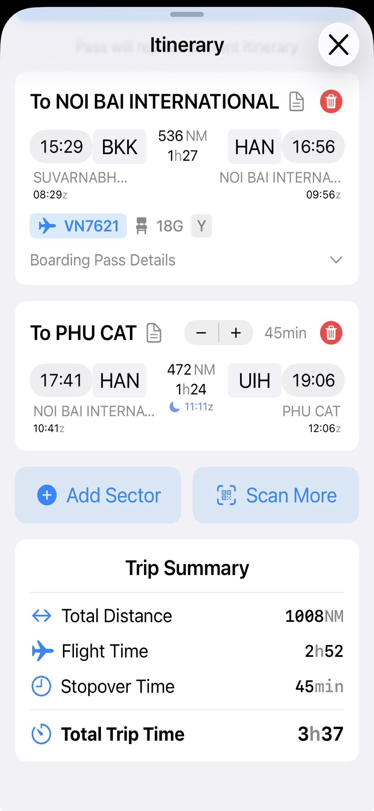
- Your stopovers are respected — a stopover you entered by hand, or one implied by a departure time you set, is no longer replaced by the automatic 45 or 75 minute value when you change an airport.
- Refuelling stops in the right place — when the aircraft cannot reach the end of the next leg, the longer refuelling stop is now planned before that leg rather than after it.
- Legs your aircraft cannot fly — if a single leg is longer than the aircraft’s range, that sector is now marked in red. No stopover in front of it can make the leg flyable, so the app says so rather than presenting the trip as valid.
- Boarding passes keep their dates — scanning a pass whose legs fall on different days no longer pulls a next-day flight back onto the previous day, and the date is read in the departure airport’s local time rather than the phone’s. “Scan More” now only adds the new legs and leaves a trip you already planned untouched.
- Apple Watch complication — it could show a previous flight: the wrong destination, or “arrived” while you were still in the air. It now goes quiet once a flight is over, and keeps counting down on its own during a live flight even when the phone is silent.
- Onboard position on Panasonic systems — the plotted track could sit up to 24 NM off the real route and move in a stutter-then-jump pattern. The coordinate feed is now decoded correctly.
- Top of descent — the marker could disappear while still in cruise in a strong headwind. It now stays on the same continuous profile as the 10,000 ft marker.
- Mach number — when the onboard system reports it, the pilot panel’s ground speed row shows the Mach number alongside the speed.
- Smoother when you set a time — dragging a departure or arrival time no longer redraws the globe on every tick of the wheel.
What’s new in version 2.4.1
A maintenance release, and mostly about the globe holding up in real use.
- The globe stays sharp — the high-resolution globe could get stuck on blurred imagery after you left the app and came back, or after opening and closing a settings sheet, and it never recovered until you restarted. That is fixed properly this time, at the cause rather than the symptom.
- Detail arrives faster — map tiles are now read several at a time instead of one after another, so detail fills in several times quicker when you pan or zoom. Returning to the app no longer reloads the whole view either, which removes a second of blur every time you come back.
- Apple Watch complication — on watchOS 27 the flight complication could appear as a solid black rectangle on the watch face. It shows destination, arrival time and progress again.
- “Arrived” at the right moment — the arrival label could appear while you were still on final approach, as soon as the estimate ran out. It now waits until the aircraft is genuinely down and slowing at the destination.
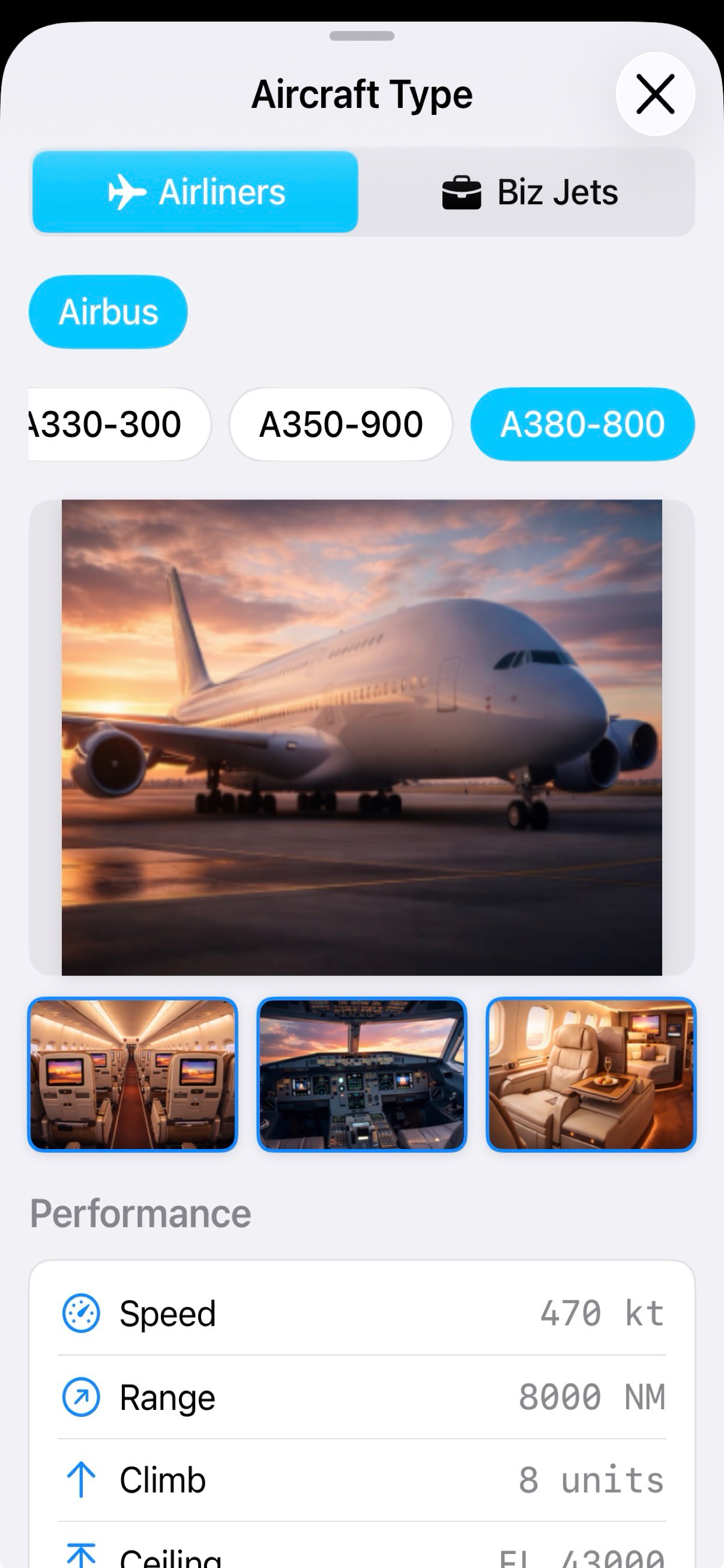
- Aircraft recognised automatically — when the onboard WiFi shares the aircraft registration, the aircraft type is set reliably, including on routes you have flown before.
- Steadier speed and heading — on onboard WiFi that reports position with limited precision, the calculated ground speed and heading no longer swing around.
What’s new in version 2.4
Version 2.4 is about seeing the world more clearly.
- High-resolution globe — turn on the optional high-detail basemap and the world becomes four times sharper as you zoom in, with coastlines, islands, terrain, and night-time city lights holding together much closer in. It downloads once from Apple, then works entirely offline like everything else. Included with Pilot Mode; it can be removed again at any time.
- Bigger text as you zoom — airport details, sunrise and sunset times, and moonrise and moonset times now grow as you zoom in close, so the globe stays readable without changing the font size everywhere else.
- Pilot Mode, clearer — locked Pilot Mode features now appear in Settings instead of staying hidden, so you can see what the unlock includes before buying.
What Off 2 shows
- Position: Continuous GPS-based tracking updated in real time
- ETA and distance: Dynamic, FMS-style calculations as your flight progresses
- Airports on zoom: Runway length, elevation, and aircraft suitability at appropriate zoom levels
- Day/night crossings: Real-time terminator with crossing time predictions
- Local & UTC time: Clear local and UTC time, with a day indicator when you cross the International Date Line
- Route visualization: See where you’ve been and where you’re going on the globe
Apple ecosystem
Off 2 runs natively across the Apple ecosystem:
- iPhone and iPad — full interactive globe experience
- Mac — native macOS app, same capabilities
- Apple Vision Pro — spatial computing interface
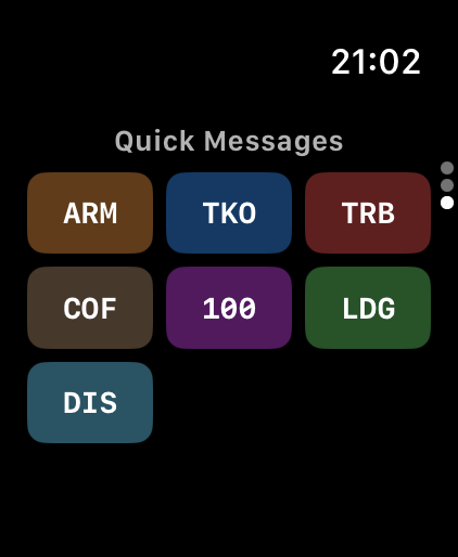
- Apple Watch — flight complications (ETA, distance) added in v1.6; aircraft WiFi integration added in v1.4
Who uses Off 2
Pilots who want a clear offline picture of their own flight. Frequent travelers curious about their route geometry. Anyone who wants real data rather than an airline’s entertainment screen map.
Frequently asked questions
Does Off 2 require an internet connection?
No. Off 2 is fully offline. The NASA globe imagery, position tracking, ETA calculations, airport data, and day/night crossing display all work without any network connection — ideal for long-haul flights with limited or no connectivity.
How does Off 2 track position without internet?
Off 2 uses the device's GPS receiver and onboard sensors. No external data source is needed.
What is the high-resolution globe?
An optional higher-detail version of the globe imagery, added in v2.4 and included with Pilot Mode. It makes the world about four times sharper as you zoom in — coastlines, islands, terrain, and night-time city lights hold together much closer in. It is downloaded once from Apple (about 423 MB, 565 MB once installed) and then works entirely offline like everything else. You can turn it off again at any time to reclaim the space.
How does the onboard chat work without internet?
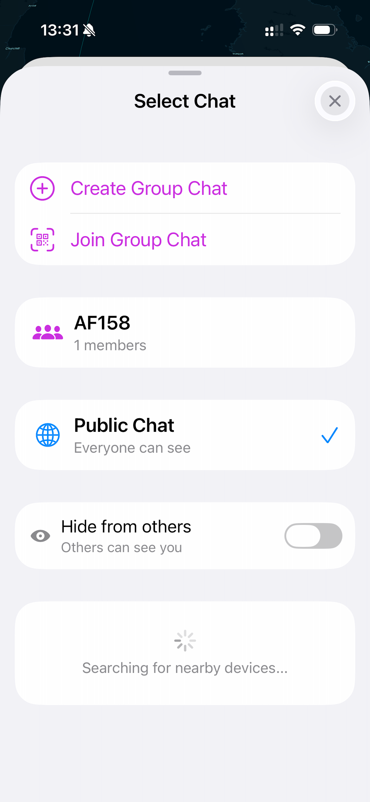
Off 2 devices find each other directly over the aircraft's local network or peer-to-peer wireless — no server, no internet. You can talk to everyone (public chat), one person (private), or a crew group joined by QR code. Messages never leave the aircraft.
How accurate is the arrival time?
The estimate models the whole flight — climb, step climbs at cruise, and descent — and is calibrated against routes that were actually flown rather than idealised great circles. Measured across 21 recorded flights, the average live error is 29% lower than the previous model and every final error came in within three minutes. It also detects a sustained early descent and rebuilds the remainder of the flight from your real position. Since v2.4.1 the arrival label waits until the aircraft is genuinely down and slowing at the destination, rather than appearing the moment the estimate runs out.
Can I plan a trip with several flights?
Yes. An itinerary can hold up to four sectors, chained automatically so each leg departs from where the previous one landed. You can scan boarding passes to fill it in, and "Scan More" appends further legs without disturbing what you already planned. Version 2.4.2 fixed a crash when deleting a sector, stopped edits to one leg from shifting the times you set on the others, and made sure a stopover you entered by hand is never replaced by the automatic value.
What happens if a leg is too long for my aircraft?
Since v2.4.2 that sector is marked in red. A refuelling stop is planned before any leg the aircraft cannot reach the end of on the fuel remaining — but if a single leg is longer than the aircraft's range, no stopover in front of it can make it flyable, so Off 2 says so rather than presenting the trip as valid. Stopover planning looks forward at the leg about to be flown, not back at the distance already covered.
What is the NASA Blue Marble globe?
In version 2.0 the globe is rendered with NASA Blue Marble satellite imagery on the day side and Black Marble city lights on the night side, blending right at the real day/night terminator — a realistic Earth that updates as you fly. All imagery is bundled, so it works fully offline.
Can I see airport information?
Yes. Zoom in and airports reveal their runway length, elevation, and suitability for your aircraft, with color-coded markers. You can choose the runway-length unit (feet, meters, NM, or statute miles) in Settings. Since v2.4 the on-globe text grows as you zoom in close, so it stays readable without changing the font size everywhere else.
Is Off 2 available on Apple Watch?
Yes. Apple Watch support (added in v1.6) includes flight complications, so you can glance at ETA and distance without reaching for your phone. Since v2.3 the complication keeps counting down on its own even when the Bluetooth link to the iPhone drops for a while. Version 2.4.1 restores the complication on watchOS 27, where it could previously appear as a blank black rectangle on the watch face, and version 2.4.2 stops it from showing a previous flight — the wrong destination, or "arrived" while you are still in the air.
What is the day/night crossing feature?
Off 2 renders the current day/night terminator line on the globe in real time, showing you exactly when your flight will cross from day into night or vice versa — useful for planning sleep and managing fatigue on long sectors.
How does Off 2 handle time zones and the date line?
Off 2 shows your local time and UTC together, derived from your GPS position. Over open ocean it labels the zone as a clear UTC offset (for example UTC-12) that matches the abbreviation, and a small +1 or -1 indicator appears when your local date differs from UTC — so crossing the International Date Line is never confusing.